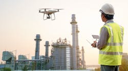
How drones can help improve security and process efficiency at your plant
Drones are quickly transforming a variety of crucial tasks, making work processes easier and safer and businesses more secure. Though some uses may pose a threat, as noted in this month’s cover story, several other, beneficial drone applications are gaining wider adoption and supporting plants’ asset monitoring and facility/environmental planning and management programs.
Automating mapping and modeling
Drone-based surveying and mapping enables mass data capture, while drone-based imaging captures the physical reality of any infrastructure or terrain. Bentley Systems’ ContextCapture software, which allows for 3D model creation from photographs captured using drones, helps plants get started in creating digital twins, Bentley’s Phil Christensen says.
“We are seeing rapid growth in the application of drones and the resulting 3D reality meshes to help inspect plants, plan modifications, and prepare for shutdowns,” says Christensen, Bentley’s senior vice president of reality modeling. “Linking the reality mesh to databases for inspection or asset management helps plant teams deliver the right data to the right people in the context of the digital twin.”
Sidestepping inspection challenges
Using drones to perform nondestructive testing (NDT) in high places eliminates the need for scaffolding for this task, allowing workers to remain safely on the ground. Apellix offers an aerial robotic system for NDT measurements such as dry film thickness (DFT), surface profile (SP), and ultrasonic testing (UT) of wall thickness.
The Apellix system flies up to a structure with a metal substrate and then, under full autonomous software control, touches an NDT measurement probe tip to the target and records the corrosion monitoring location’s measurement data, says Robert Dahlstrom, founder and CEO of Apellix. The system also contains gas sniffers, environmental sensors, and visual systems and cameras to create a full, auditable data record.
For indoor and confined-space inspections, Elios from Flyability is a collision-tolerant drone that can navigate boilers, chimneys, tunnels, tanks, and other confined and complex industrial spaces. Using drones indoors in addition to outdoors is “a very new idea that comes with high technical challenges: complex, unstructured environments with obstacles, flight beyond the line of sight, darkness, dust, etc.,” observes Patrick Thévoz, co-founder and CEO of Flyability. “In addition to reducing costs, Elios has a huge impact on downtime and reduction of risk for humans, which has savings impacts often an order of magnitude higher than pure inspection costs,” he comments.
Natural-gas leaks can be detected in remote pipelines and refinery process units with the drone-mounted UAV-Microportable Methane/Ethane analyzer from ABB, which is designed to efficiently locate, validate, quantify, and map leaks. In trials, it was “often able to find new leaks that evaluators had overlooked using their current methods,” says Marc-Andre Laliberte, ICOS products manager for ABB Measurement & Analytics.
Underwater drones support subsea asset monitoring and inspections, site surveys, integrity monitoring, imaging, and security. Tritech International’s Gemini 1200ik dual-frequency sonar is designed to optimize autonomous underwater vehicle (AUV) and remotely operated vehicle (ROV) performance.
The ability to “see” in zero-visibility conditions is a key requirement for AUV/ROV operators, says Tritech engineering director Mark Knox. “Gemini 1200ik multibeam sonar’s dual modes combine low-frequency operation for target identification and obstacle avoidance at long range with high-frequency operation providing extremely detailed multibeam images,” he explains.
Going the distance
Flying beyond the visual line of sight (BVLOS) represents the next big opportunity for commercial drone operations, suggests Tyler Collins, vice president of energy at PrecisionHawk. Though federal authorization to conduct these flights is limited, drone operators who are permitted to deploy BVLOS operations are no longer limited to keeping their drone within direct view during flight. This is especially useful for utilities managing lines that traverse vast, sometimes mountainous terrain or offshore locations, he notes.
PrecisionHawk incorporates assistive technology that enables drone tracking, real-time manned aircraft identification, and detect-and-avoid technology for any BVLOS operation. “Choosing the right assistive technology is critical to safe BVLOS flight and to earning FAA approval for expanded operations,” Collins advises.
Drone delivery of auto parts between two production plants, two kilometers apart, is being piloted in Spain by Volkswagen Group subsidiary SEAT and Grupo Sesé under the supervision of the Spanish Aviation Safety and Security Agency. The deliveries take 15 minutes versus 90 minutes by truck.
Mitigating hazards
For external threats, consider surveillance and counter-drone technologies. Interceptor from the startup Anduril Industries is a new counter-unmanned aerial system (cUAS) designed to detect and interdict or “kill” enemy drones. Its automated target acquisition is said to allow operators to quickly and effectively neutralize external threats.
This article is part of our monthly Technology Toolbox column. Read more from Sheila Kennedy.


